
By R S Tejus:
A dam that could cost the state of Karnataka, a River and pristine untouched Forests of Cauvery Sanctuary, the “Mekedatu Balancing Reservoir & Drinking Water project” will submerge close to a whopping 53 sq kms of Cauvery Sanctuary’s forests. Natural resources are assets for the entire nation but their degradation in the name of development will not only have a lasting impact but also add to more deep-rooted problems.
The forested landscapes of Cauvery, MM Hills, and BRT are vital for conserving wide-ranging wildlife such as the Tiger, Elephant, Leopard etc. The first two belong to the Eastern Ghats Mountain range while the last one is where both the Eastern and Western Ghats meet.

So, this makes the forests of BRT, one of the unique habitats in the world where one can see forests from evergreen to the dry deciduous.
These three Protected Areas (under the purview of the Wildlife (Protection) Act, 1972) are spread across an area of more than 2000 sq km, making it one of the prime interconnected forests in our country. These are old-growth forests, essential for carbon sequestration which helps mitigate climate change and global warming. Bannerghatta National Park borders Cauvery Sanctuary to the north and Tamil Nadu’s forests.

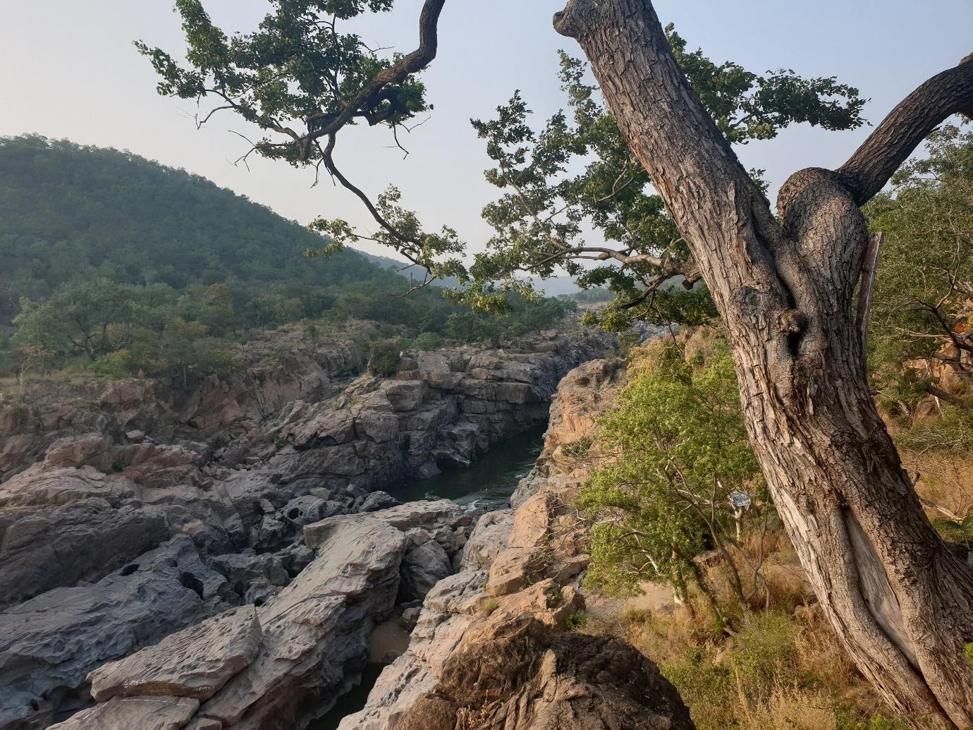
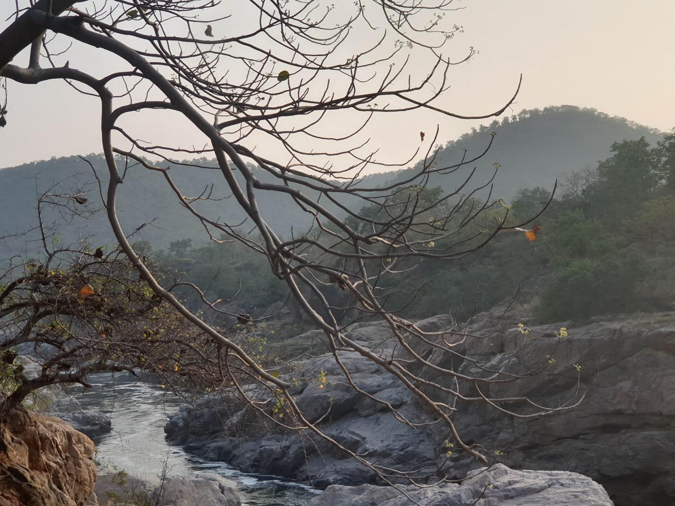
River Cauvery passes through Cauvery Sanctuary for 70 kms harboring the Masheer fish, Crocodiles, otters and many other species. Mekedatu is a beautiful gorge made by the river while Sangama is a place where river Arkavathy meets Cauvery, Hogenikkal falls, and Muthathi. All these make irreplaceable geographical sites of importance.
MM Hills (Male Mahadeshwara) Sanctuary is an ecosystem that is fragile and unique. The Sanctuary is spread across an area of 900 plus sq kms. The plateaus in the MM Hills are characterized by chains of high hills with varying altitudes. The highest point is in Ponnachi- 1514 meters above sea level. Most parts of the Sanctuary are dry deciduous and scrub with undulating terrain. It also includes pockets of Sholas, evergreen and semi-evergreen and moist deciduous.
Many streams flow through the Sanctuary, namely Uduthore Halla, Gundaal, Santhekan Halla and a few smaller streams. The former two streams drain into river Cauvery and Palar. There has been a rise in temperature in the area touching 40 degree C and beyond in the basin; this results from deforestation and degradation of forests.
With an area of 574 sq km, BRT Tiger Reserve consists of all types of forests. The elevation here ranges from 600-1950 meters above sea level. This reserve acts as a major ecological bridge between the Eastern Ghats and the Western Ghats and is a crucial point w.r.t environmental heritage. The name of the reserve is after the famous temple of Lord Ranganatha. In Sanskrit, these hills are called Swethadri, meaning white hills, because the weathered granite hill appears white. The forests got their prominence after the writings of R C Morris, who wrote several papers on the importance of the forests of BRT to the BNHS.

Cauvery Sanctuary is spread across an area of more than 1000 sq km. The river Cauvery which is the lifeline of millions in southern Karnataka, flows a considerable length of 70 kms bordering the Sanctuary and an inter-state boundary of Karnataka and Tamil Nadu. A significant portion of the Sanctuary is of dry deciduous type.
The pre-feasibility report of the balancing reservoir project contains unscientific principles like tapping the excess water flow to the sea, which in real sense there is nothing such as excess or deficient water! The project’s main objectives are to provide drinking water to the Bengaluru Metropolitan Region & adjoining areas, regulate the flow of water to TN and for generating power of nearly 400 MW.

The supply & demand of water resources in India is subject to very complex & ever-changing prospects of increasing population, growth in industrialization, rapid urbanization & the like. The demand for water 5 years ago would not be the same during the current period & in the future, the change is inevitable. Whereas the supply of water sees a decline over the period due to various reasons such as fluctuating rainfall, climate change, construction of back-to-back dams… Much like the untruth of “wider the road lesser the traffic.”
The population trend of Bengaluru is on the upward trend where the current number stands approximately at 12 plus million. The increase is steady since the 1950s and is expected to reach 18 plus million at the end of 2035.

On the other hand, the Cauvery River is getting thinner & drier with constant subject to pollution, deforestation & the like. River Cauvery (including tributaries) is already saturated with many dams and barrages (100+) but the state government is still unable to solve the water crisis and this is due to supply-demand variation and poor water resources management.
Solving the drinking water crisis should be local. Understanding the best water management technologies from all countries is the need of the hour and implementing the best solutions. More impetus should be given to utilizing rainwater to its utmost potential because there lies the key. To utilize an additional 4.75 TMC of Cauvery water by building a dam in Mekedatu that joins the sea through a delta will only add to disaster. River water joining the sea is not a waste and has its ecological value and any tampering would lead to severe eco-concerns.

Conservation of lakes in urban areas, utilization of rainwater, implementing what other countries are doing in terms of providing drinking water and use of best science and technology is the need of the hour. Planting trees in the name of conservation by destroying old-growth forests is a hoax and a myth because trees cannot replace the rock structures, forests and wildlife.