
byMeera Bhardwaj
The lakhs of ‘rejected land claims’ made under Forest Rights Act (FRA), 2006 can be decided and accepted only after evaluation by satellite imageries; in fact, the Supreme Court has directed the Forest Survey of India to furnish a report on encroachments based on satellite imagery survey. But how many states have used this state of the art technology to detect whether FRA claims are bogus or genuine is the moot question?
Although Gujarat, MP, Kerala and AP have made attempts to map the land and identify the claimants by using GPS technology, the usage of GIS for Forest Rights in Maharashtra has provided fair and accurate evidence in support of the forest rights recognition process under the FRA, 2006.
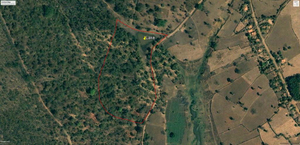
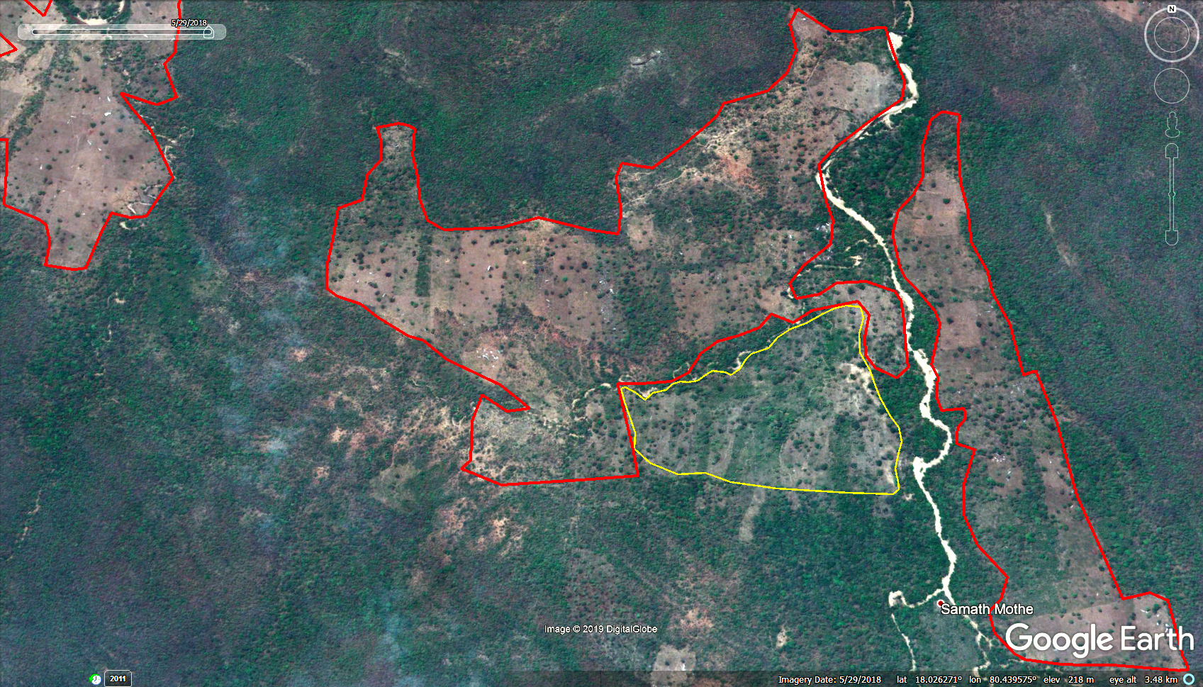
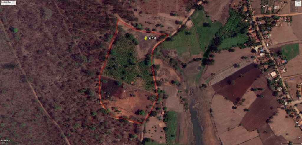
Maharashtra is the only state that has used technology and satellite imageries to process claims while other states are way behind. Several independent agencies including the Saxena Committee appointed by Ministry of Tribal affairs itself, TERI appointed by Maharashtra Government and Bhaskaracharya Institute of Space Applications for Gujarat Government have already documented fresh clearance of forest land even after the 2005 cut-off date by satellite imagery analysis.
In fact, the RS-GIS based analysis of FRA rights in Maharashtra has proved that people had cleared forests and converted barren lands into agricultural lands. It was further observed during the analysis that rights have been recognized for those claimants who were not eligible right holders as per FRA.
The TERI study also indicated that Nandurbar, Jalgaon, Gondia and Gadchiroli districts are highly vulnerable to climate change. The vulnerability due to the climate change becomes more critical in these districts due to the impacts of wrong recognition of forest rights against the provisions of FRA. The analysis was done based on the scrutiny of 66,300 FRA rights on 1,07,897.9 ha of land spread over19 districts in the state surveyed in 2005-06, 2007-08 and 2011-12 by the Logicstacks Solution, Pune.
It may be recalled that Maharashtra Government implemented FRA for individual and community Forest rights. A total of 1,08,112 (1,05,506 individual and 2606 community) rights were recognized which entailed 3,05,561.9 hectare forest land. It was observed that 14,668.96 hectare were recognized against the provision of FRA including 1748.45 hectare forest land with tree cover which has been deforested and recognized as individual rights.
Even Bhavya Goswami’s research report on Geo Informatics for Forest Rights (One World Foundation India) states Maharashtra has used extensive ICT tools which leads to increased accountability and transparency in the process of granting forest rights. The use of technology has reduced corruption for claiming forest rights by providing legal evidence to support the forest rights recognition process. Till 2010, GPS machines had measured 1.16 lakh cases making the technology a standardized tool for implementing FRA across the state.
In Maharashtra, the GIS system has been highly impactful in enabling timely recognition of forest rights for eligible claimants and rejecting ineligible claims thereby, saving forest land and discouraging people, who engage in illegal encroachment of forest land, concludes Goswami.
In fact, a review done by the Prime Minister in 2015, specific directions were given to all states to use high resolution satellite imageries of one meter or less to determine the position of FRA claimants who were in possession of land before the cut off year. Therefore, stunningly accurate imageries which are available with various government and private organizations can clearly determine the eligible tribal and OTFD claims and finally put an end to the plethora of bogus, non-tribal claims.
Meanwhile, the National Remote Sensing Centre, ISRO has completed the detection of forest cover loss using IRS in 8 states which has India’s 40.54 per cent of forest cover while the detection of national coverage is in progress. Satellite imagery evidence of forest encroachment / loss has been considered by the CAG as well and accepted by the Supreme Court and High Courts in many other cases and this is the only way to clear the mess in FRA implementation.
Comment here