
R S Tejus:
The widening of NH-73 project proposal has been questioned by the Centre as it involves felling of a whopping 7,540 trees, major landslide risks, impact on wildlife movement and on compensatory afforestation site identification. The serious ecological and wildlife concerns had earlier been highlighted and focused by Green Minute News ( greenminute.in ) in a story published on September 24, 2026 which has nowcome under official scrutiny.
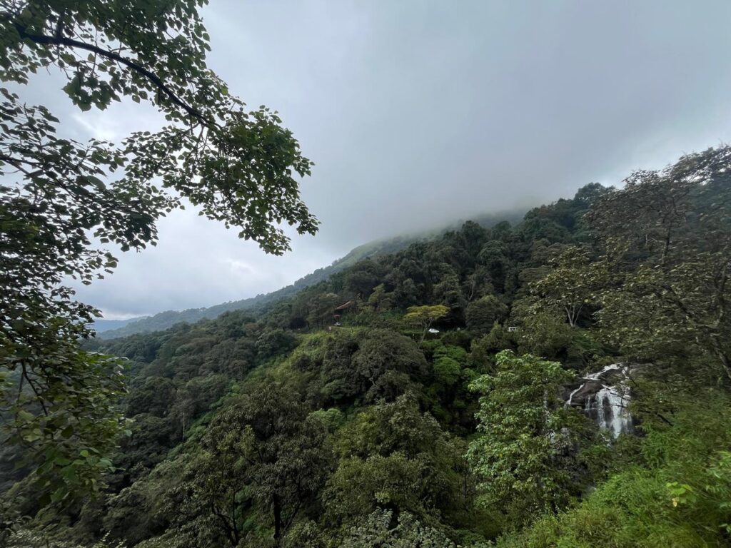
The Union Ministry of Environment, Forest and Climate Change (MoEFCC) has flagged major discrepancies and environmental concerns in the proposal to widen National Highway-73 through the landslide-prone Charmadi Ghat in Karnataka.
The ministry’s regional office has sought clarifications on the proposed diversion of 15.66 hectares of forest land, felling of 7,540 trees, wildlife movement, landslide risks and compensatory afforestation.
According to documents available on the PARIVESH portal, the regional office has raised 11 queries covering several aspects of the project. It has also suggested restricting road widening to curves instead of carrying out extensive widening through the ecologically sensitive Western Ghats.
Reacting to the development, Mangaluru-based wildlife conservationist Vivek M., who had raised these concerns with the state and central forest authorities in June and September, welcomed the ministry’s intervention.
“It is heartening that these gaps have been flagged before the proposal went further, and that due process still has room to course-correct,” Vivek said in a press statement issued on October 18.
Concerns reported by greenminute.in now under official scrutiny
On September 24, 2026 greenminute.in published a detailed report titled “NH-73 Widening – A Doomsday Project for Landslide Prone Charmadi Ghat” (https://greenminute.in/2026/09/24/nh-73-widening-a-doomsday-project-for-landslide-prone-charmadi-ghats-in-karnataka/), examining the environmental implications of the proposed widening.
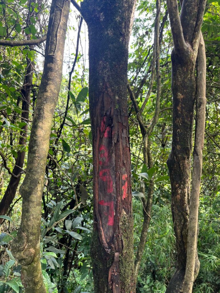
The report highlighted large-scale tree felling, the importance of the Kudremukh–Pushpagiri Tiger Corridor, the risk of landslides, the absence of adequate wildlife mitigation measures in the records examined, and concerns over compensatory afforestation. Several of these issues have now become part of the formal queries raised by the ministry’s regional office.
The earlier report also noted that Karnataka’s PCCF and Head of Forest Force had recommended in-principle Stage-I approval on September 10, 2026. According to Vivek’s subsequent statement, the State Chief Secretary recommended Stage-I approval on September 23, despite the concerns he had already placed before the authorities.
The latest development is significant because the central ministry has now sought further information on many of these issues before the proposal can be processed further.
Felling of 7,540 trees raises serious concerns
The proposed widening covers approximately 11.2 km of NH-73 between existing kilometre markers 75.00 and 86.20 of the Mangaluru–Mudigere–Tumakuru highway section. According to the project documents, 7,540 trees belonging to 52 species have been identified for felling. Of these, 853 trees have a girth exceeding 120 cm.
The regional office has expressed concern over the number of trees proposed for removal, particularly in the ecologically sensitive landscape of Western Ghats.
It has asked the State Government to revisit the proposed road design and alignment to explore whether the number of trees to be felled can be reduced. Revised details have also been sought.
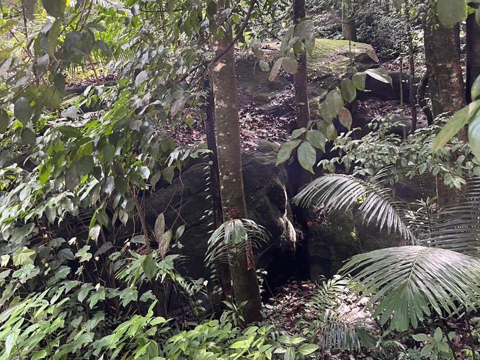
The Charmadi–Kannappadi Reserved Forest forms part of the central Western Ghats, with steep hills, valleys, streams and forest habitats. The earlier Green Minute News report also highlighted the importance of large evergreen and semi-evergreen trees in maintaining forest conditions, storing carbon and protecting the soil.
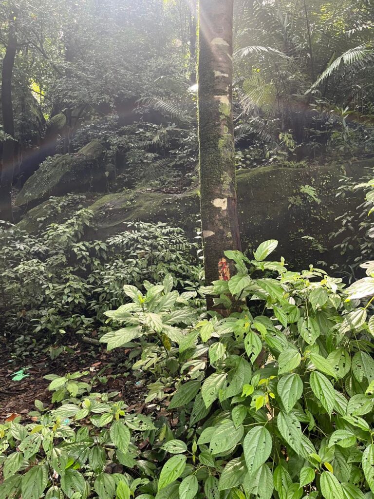
The proposed felling therefore raises concerns beyond the number of trees alone. Removing trees from steep slopes can affect soil stability, surface runoff and the surrounding forest habitat. The ministry has specifically linked the scale of tree felling to the existing landslide risk in the area.
Widening may be restricted to Curves
One of the important observations made by the regional office concerns whether extensive widening is necessary along the proposed stretch.
The Deputy Conservator of Forests had recorded a high risk of landslides in the area, while the project authorities themselves acknowledged that the terrain has very steep slopes.
The regional office observed that the removal of thousands of trees could further increase the risk of landslides in a region already vulnerable to such events. It has therefore suggested that widening may be restricted to curves, instead of undertaking extensive widening throughout the proposed stretch.
The office has also called for a detailed landslide-prevention plan, prepared in consultation with the Forest Department, explaining the measures proposed to protect the slopes.
The MoEFCC observations are important in the context of Charmadi Ghat’s history of landslides.
In his earlier representations, Vivek had referred to a Geological Survey of India study documenting 45 landslides associated with previous road-construction works along the studied stretch. The study, as cited in his representation, had also recommended avoiding vertical cut slopes.
Vivek had questioned the absence of a detailed geological and landslide assessment in the project records reviewed by him.
The earlier Green Minute News investigation also pointed to the need for examining slope cutting, drainage, slope stabilisation and the disposal of excavated material.
These issues are particularly important in high-rainfall terrain, where disturbing steep slopes without adequate engineering measures can increase the possibility of slope failures.
Road passes through NTCA-recognised tiger corridor
The proposed widening has also raised concerns about wildlife movement and forest connectivity.
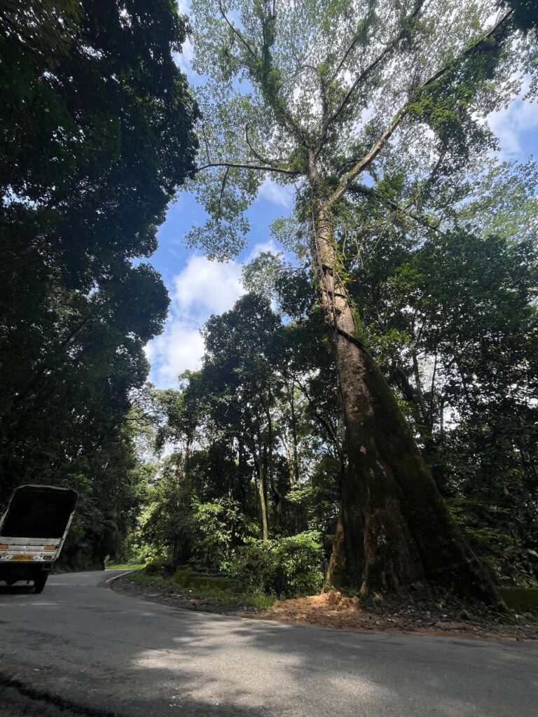
According to the regional office’s observations, the DCF had reported that the road passes through a tiger corridor. This was subsequently verified using the ministry’s Decision Support System, which indicated that the forest area proposed for diversion falls within the Kudremukh–Pushpagiri Tiger Corridor recognised by the National Tiger Conservation Authority (NTCA).
The DCF had also identified the area as an important habitat and movement corridor for wild elephants and other animals.
The Charmadi–Kannappadi Reserved Forest supports the movement of elephants, gaur, sambar and other wildlife between forest areas on either side of the existing highway.
Earlier examination by the Forest Department recorded that approximately 5.33 km of the road passing through forest land and another 1.75 km passing through non-forest land fall within the tiger corridor. The proposed widening could therefore affect wildlife movement beyond the forest land directly required for the project.
The regional office has sought details of the proposed wildlife mitigation measures, supporting justification and an implementation plan.
It has also suggested that a detailed wildlife mitigation plan be prepared in consultation with the Wildlife Institute of India (WII), along with obtaining the necessary clearances from the State Board for Wildlife and the National Board for Wildlife, wherever applicable.
Vivek had earlier questioned why the wildlife clearance process had not been initiated when the proposal was being recommended for Stage-I approval.
His representations also raised concerns about the alignment passing through the Eco-Sensitive Zone of Kudremukh National Park and the need for the relevant environmental scrutiny.
The MoEFCC’s observations now make wildlife movement and mitigation important issues requiring examination before the project proceeds.
Differences in forest area and village details
Apart from environmental concerns, the regional office has identified discrepancies in the official documents relating to the extent and location of forest land proposed for diversion.
A communication from the PCCF and Head of Forest Force to the Additional Chief Secretary mentioned 15.6617 hectares of forest land covering Charmadi and Neriya villages.
However, the State Government’s communication to the regional office mentioned 15.1758 hectares, covering Charmadi and Neriya villages in Dakshina Kannada district and Attigere village in Chikkamagaluru district.
The difference between the two figures is 0.4859 hectares.
The regional office has asked the State Government to clarify the exact area required and furnish the names of all villages involved.
A separate discrepancy concerns the forest divisions.
While the PCCF’s communication mentioned only Mangaluru Forest Division, the State Government’s letter referred to both Mangaluru and Chikkamagaluru Forest Divisions.
Clarification has been sought on the divisions under whose jurisdiction the proposed diversion falls.
The DCF’s earlier examination recorded that the total 15.6617 hectares comprised 13.9506 hectares of notified forest land and 1.7111 hectares of deemed forest.
These details are important for determining the exact forest area affected by the project.
Existing road details and approval history questioned
- The ministry has also sought clarification on the history of the existing highway.
- One of the regional office’s queries describes the proposal as widening NH-73 to four lanes.
- However, an earlier DCF reply describes the work as widening the existing road to a two-lane carriageway with paved shoulders.
The DCF’s reply refers to the stretch between Km 75.00 and Km 86.20, proposed to be executed under the National Highways programme on Engineering, Procurement and Construction (EPC) mode through the National Highway Division of the Public Works Department in Mangaluru.
The regional office has asked the State Government to establish whether the existing road was constructed before 1980.
If the road existed before 1980, documentary evidence must be furnished. The office has also referred to Paragraph 11.5(i) of Chapter 11 of the applicable guidelines, requiring the forest land within the existing carriageway constructed before 1980 to be included in the diversion application and shown separately.
Accordingly, the area proposed for diversion may have to be revised and submitted in a tabular format showing the existing and additional areas separately.
If the road was constructed after 1980, the authorities have been asked to produce the relevant forest diversion approvals and compliance reports relating to the conditions imposed.
These queries seek to establish the legal and documentary history of the road and the exact extent of forest land involved in its proposed widening.
Compensatory afforestation (CA) site also questioned
The compensatory afforestation proposal has come under detailed scrutiny.
According to the records, 18 hectares have been identified in Survey No. 17 of Ganguru village, Bhadravathi taluk, Shivamogga district, for compensatory afforestation.
However, the regional office has observed that the identified land for CA appears to fall within the boundary of Dodderi Minor Forest.
It has therefore sought clarification on whether the land is revenue non-forest land and whether it is free from the provisions of the Van (Sanrakshan Evam Samvardhan) Adhiniyam, 1980.
The State Government has been asked to furnish:
- authenticated revenue records,
- including Records of Rights, Tenancy and Crops (RTC),
- survey records and
- other documents establishing ownership, classification and legal status of the land.
Where documents are in languages other than English, authenticated English translations have also been sought.
Another concern is the existing vegetation at the proposed CA site.
The regional office has observed that the land identified for compensatory afforestation (CA) already has a canopy density exceeding 0.5. A Crop Improvement Scheme has been submitted for the area, but the office has sought a detailed year-wise schedule explaining the proposed activities.
It has also questioned the inclusion of chain-link fencing, thinning and climber cutting in an area with an established crop of vegetation. The authorities have been asked to justify the necessity and relevance of these activities. The regional office has suggested excluding them from the scheme if they are not required.
The observations raise questions about the suitability of the identified land and the ecological benefit expected from the proposed compensatory measures.
Land previously handed over for Afforestation
Another important issue concerns land in Neriya village that had already been handed over to the Forest Department for compensatory afforestation under a separate and a totally different project.
The DCF’s earlier examination noted that approximately five acres, described in the records as 2 hectares, in Survey No. 148/1 of Neriya village had previously been handed over by the Trinetra Power Project for compensatory afforestation.
A portion of this area is involved in the proposed NH-73 widening.
The DCF had therefore asked the project authorities to separately demarcate and identify on the map the part of this compensatory afforestation land proposed to be used for the road. The issue is important because it involves land previously identified to compensate for forest diversion under another project.
The latest regional-office queries concerning the new compensatory afforestation site add to the questions already raised about the project’s forest land records.
Earlier mapping errors and corrections
The PARIVESH history shows that questions concerning the proposal had been raised well before the latest intervention by the regional office.
On November 7, 2025, the State authorities had pointed out that the start and end connectivity of the proposed road section had not been properly provided. The proposed area appeared to end abruptly in forest land, while details of the adjoining non-forest area were missing.
Another observation concerned the clarity of the village maps. The maps of Attigere and Charmadi were not clearly visible in the submitted documents.
The authorities also noted that portions shown as non-forest land appeared, according to the Karnataka forest information system data, to fall within Charmady–Kanapadi Reserved Forest in the Balur area and the Neriya deemed forest area identified in 2015.
Field verification was therefore sought.
The project proponent replied to these observations on January 8, 2026, stating that they had been noted and complied with.
In the DCF’s reply dated July 18, it was reported that the submitted map did not include GPS data for the existing road. Without this information, the exact extent of forest land required for diversion could not be determined.
The project authorities were asked to incorporate the GPS details and resubmit the map for examination.
Further corrections were made following a field visit on August 13 involving the Range Forest Officer of Belthangady Range.
During that visit, it was observed that a portion of Survey No. 147 in Neriya village also fell within Survey Nos. 146 and 148. The project proponent stated on August 24 that the necessary corrections had been made and the revised proposal submitted.
On August 31, the State authorities again directed verification of the revised proposal and submission of the relevant Part-II report and recommendation. The DFO responded on September 1.
The DCF’s report also referred to a site inspection conducted on June 22, 2026.
These records show that the proposal has undergone several rounds of corrections and examination, particularly concerning maps, survey boundaries, forest classification and wildlife movement.
Questions remain over forest valuation
Vivek’s earlier representation had raised another issue concerning canopy density at the actual forest diversion site.
According to the documents cited in the September Green Minute News investigation, the DCF’s report recorded a canopy density of 0.1 for the forest land proposed for diversion.
Vivek had questioned whether this figure accurately reflected the actual forest conditions and had called for independent verification using the Working Plan and field records.
Canopy density is relevant to the assessment of forest land and the calculation of Net Present Value (NPV), which forms part of the compensatory payments associated with forest diversion.
This concern is separate from the ministry’s observation that the proposed compensatory afforestation land has a canopy density of more than 0.5.
While the regional office has explicitly questioned the compensatory afforestation scheme, the available EDS history does not record a separate finding confirming that the 0.1 canopy density figure at the diversion site is incorrect.
Call for cumulative environmental assessment
Vivek has called for a wider assessment of the environmental consequences of the project rather than examining the present road section in isolation. The current diversion proposal covers approximately 11.2 km. However, he has raised concerns that further widening towards Mudigere could involve additional forest land, tree felling and hill cutting.
He has urged the authorities to conduct a cumulative environmental impact assessment covering the entire Charmadi–Mudigere alignment. Such an assessment would help examine the combined effects of road expansion on forest connectivity, wildlife movement, landslide risks and the surrounding landscape.
Alternative Approach to CA
Vivek has also suggested examining an alternative approach to compensatory afforestation, including whether the ongoing voluntary relocation programme within Kudremukh National Park could provide a suitable option under the applicable rules.
The proposal would require examination and approval by the competent authorities before it could be considered an eligible compensatory afforestation measure.
What happens next?
The PARIVESH EDS history generated on October 18 shows that the latest regional-office queries had not received replies at the time of generation. The record shows queries raised by the regional office on October 8 and 9. A further entry dated October 17, raised by the State Secretary, calls for replies to a query dated October 15.
The project has not been rejected. However, several issues relating to forest diversion, wildlife protection, slope stability, compensatory afforestation and the accuracy of the submitted documents remain to be addressed.
The State Government and project authorities will now have to provide the required clarifications and supporting documents for further examination.
Improving road safety through Charmadi Ghat remains an important public concern, particularly given its steep terrain and landslide history. At the same time, the observations made by the ministry underline the need to examine whether safer travel can be achieved through targeted engineering improvements without causing avoidable forest loss.
The latest developments have brought several concerns earlier raised by conservationists and reported by Green Minute News into formal scrutiny. The outcome will depend on how thoroughly the authorities address the questions now placed on record and whether the project can balance road safety with the long-term protection of this ecologically sensitive Western Ghats landscape.
(PHOTO CREDIT: ALL IMAGES BY VIVEK M, WILDLIFE CONSERVATIONIST, MANGALURU)